Rwanda's Agriculture
|
Total Area: 26,338 sq km
Land Area: 24,668 sq km Water Area: 1,670 sq km Climate description: temperate; two rainy seasons (February to April, November to January); mild in mountains with frost and snow possible Terrain description: mostly grassy uplands and hills; relief is mountainous with altitude declining from west to east Arable Land Use: 46.32% Permanent Crop Land Use: 9.49% Irrigated Land: 96.25 sq km Total Renewable Water Resources: 9.5 cu km 
A woman in Rwanda harvests coffee beans.
Click here to view this source 
Rwandan farmers carry their tea crops.
Click here to view this source |
Total Freshwater Withdrawal: 0.15 cu km/yr
Per Person Freshwater Withdrawal: 17.25 cu m/yr Natural Hazards description: periodic droughts; the volcanic Virunga mountains are in the northwest along the border with Democratic Republic of the Congo Environmental Current Issue: deforestation results from uncontrolled cutting of trees for fuel; overgrazing; soil exhaustion; soil erosion; widespread poaching Total Labor Force: 4.446 million % of Labor Force in Agriculture: 90% Agricultural Products description: coffee, tea, pyrethrum (insecticide made from chrysanthemums), bananas, beans, sorghum, potatoes; livestock 
A woman harvests her tea crops.
Click here to view this source 
Rwandan farmers shape the hills to improve their cultivation.
Click here to view this source |
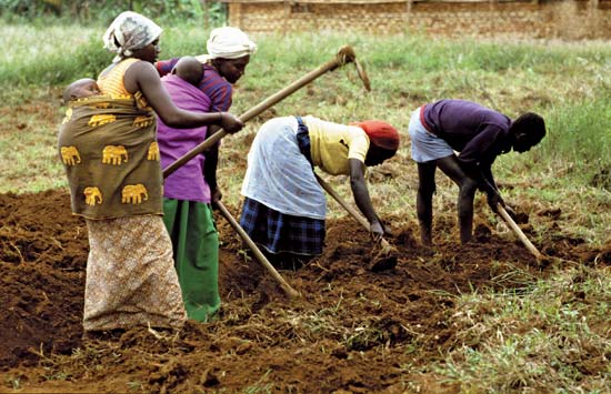
Most farming in Rwanda is still done with hand tools rather than machinery.
Click here to view this source |
